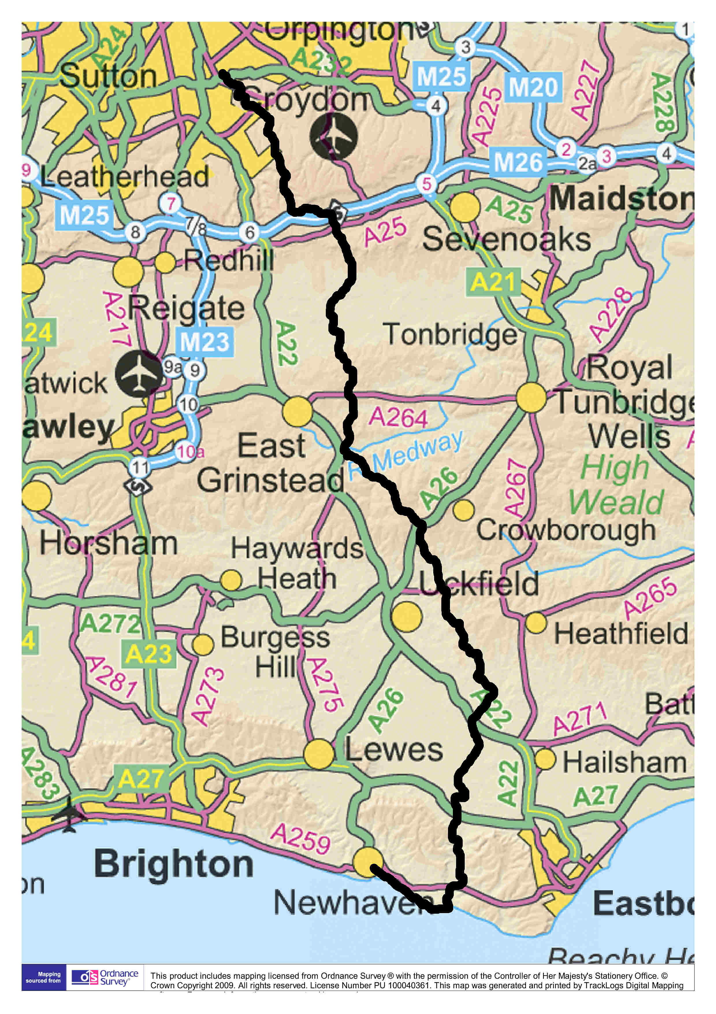
The Vanguard Way
|
66 miles from the suburbs to the sea
|


|
|
|
| |
|
Vanguard Way Association
Membership is open to anyone who would like to help us raise funds for signage and get a newsletter with details of social events.
You can also volunteer on our committee or as a ranger, or just pay a £ 10 per year membership fee click here for details of Membership benefits or email membership@vanguardway.org.uk with your name(s) and address.
Donations also help fund signage along the route.
It's the perfect route for walkers!
All right, this is our opinion!
And, yes, we would say that, but this is why we think so:
|
 |
 |
a designated National Park (South Downs); |
|
|
two Areas of Outstanding Natural Beauty (Surrey Hills, High Weald); |
|
|
a heritage coast (Sussex Coast); |
|
|
two scheduled sites of national or regional interest (Nore Hill Chalk Pinnacle, and Dry Hill Camp) and many other points of
interest. |
|
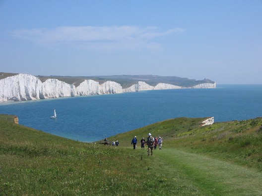
The Seven Sisters, 2009 Micky Kohn
|
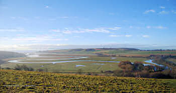
Cuckmere Meanders, 2009 Colin Saunders
|
Nearly all the route is on public rights of way, and goes mostly through open countryside and woodland. The route is well served by public transport, so you can easily walk it on day trips from London. You'll learn something new every day. When you complete the route you qualify for a certificate, and you
can commemorate your achievement with a badge. And there are FREE GUIDES & MAPS
and GPX Files
describing the route from North to South and from South to North! Please remember to click on latest news,
before setting off, for information on diversions and other changes to the
route. Remember, our downloadable guides and news pages provide the most
up-to-date and accurate description of the route. Maps from other
sources may be out of date and route markers may be missing or point the
wrong way.
If you want to find out what is going on along the Vanguard Way, visit our blog site
vanguardwayblog.blogspot.co.uk. You can
click here to download
a comprehensive guide to the Flora, Fauna & Geology of the Vanguard Way |
To find out more click here:

|
Free PhotoGuide App for Iphone or Android
Guidance, Photos & Maps at every junction
Our App contains guidance and 3,000 photos to show what the route looks like and guide you.
Use your own WiFi to download sections to view offline and see the route BEFORE you setoff.
It includes Maps (Offline or Online with a blue dot to show where you are).


The Vanguard Way PhotoGuide App is available for free on the Appstore or on GooglePlay:
2025 John Jefkins
|
|